Get booked in today for a free consultation: 0333 335 5273 | 07840095504 | info@rotoris.co.uk
Menu
Menu
Menu
Drone Surveys and Mapping
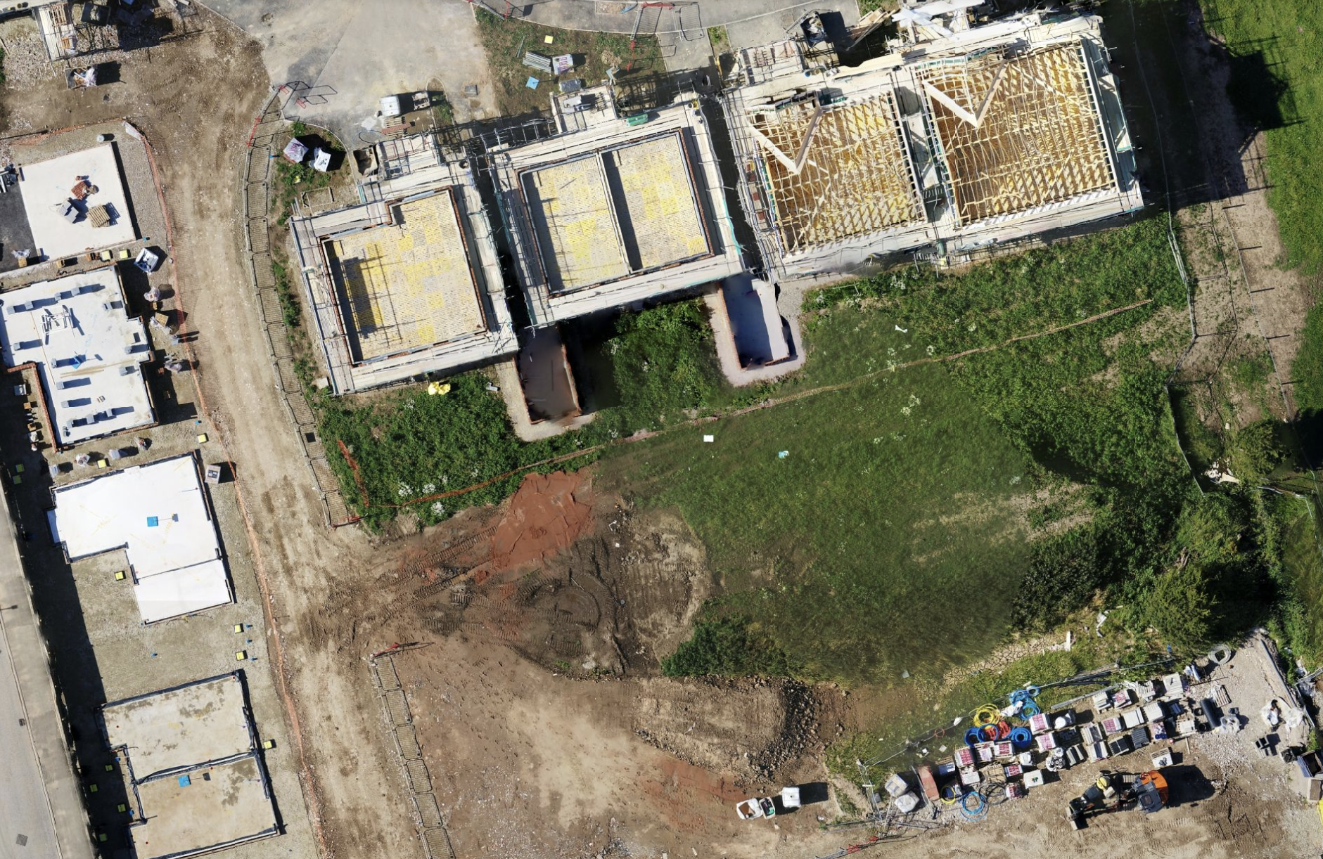
Specializing in drone surveys and mapping, we utilize advanced drones with high-resolution cameras and sensors. Consequently, these drones capture precise data for assessing assets across various industries. Additionally, our skilled team ensures thorough surveys of landscapes, construction sites, and agricultural fields.
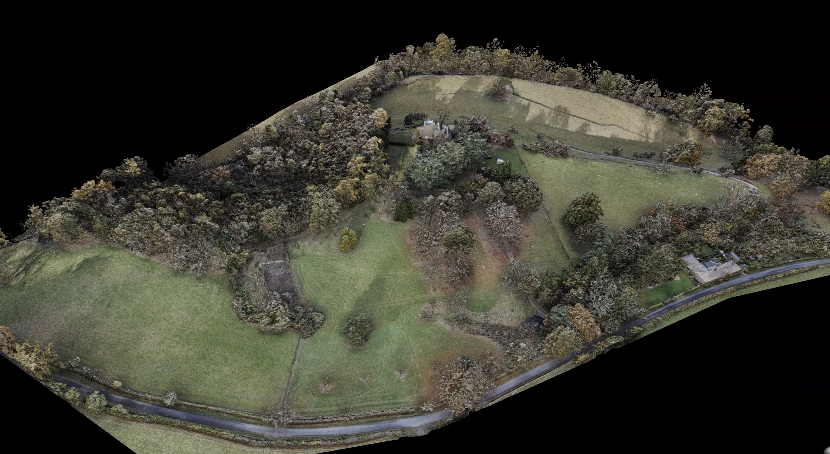
Furthermore, our drone surveying services provide accurate and efficient results. This empowers clients to make well-informed decisions based on current geospatial information. Whether it’s topographic mapping or 3D modeling, we offer customized photogrammetry solutions to meet diverse project requirements. All data is processed in-house, ultimately enhancing project outcomes and optimizing operational productivity.
Real-time Actionable Data
From project initiation to completion, our customers benefit from unparalleled interactivity and measurement data through Drone Surveys and Drone Mapping.
Maximising Project Insights
In addition to providing vital data for project smoothness, we offer a detailed and interactive experience for project stakeholders and senior management teams.
Furthermore, in topographic surveys, we efficiently survey large land areas using the latest in UAV technology, saving time compared to traditional methods.
Moreover, in 3D Modeling & Reconstruction, accessible 3D models allow remote exploration by senior management and stakeholders.
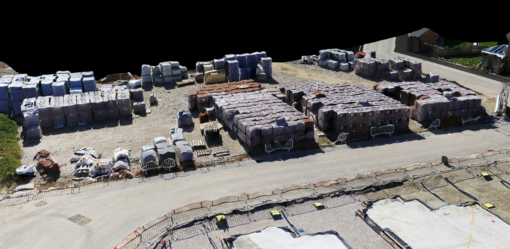
Additionally, in Earthworks Data, we gather cut and fill data efficiently using enterprise-level UAVs, providing a detailed site elevation map.
Also, in Stockpile Volume Reports, accurate data capture methodologies provide key insights into projects such as stockpile volumes.
Besides, in Aerial Photography & Videography, professional site progress updates are presented in dynamic photography and videography. These updates are edited to suit our customers’ brands at no extra cost.
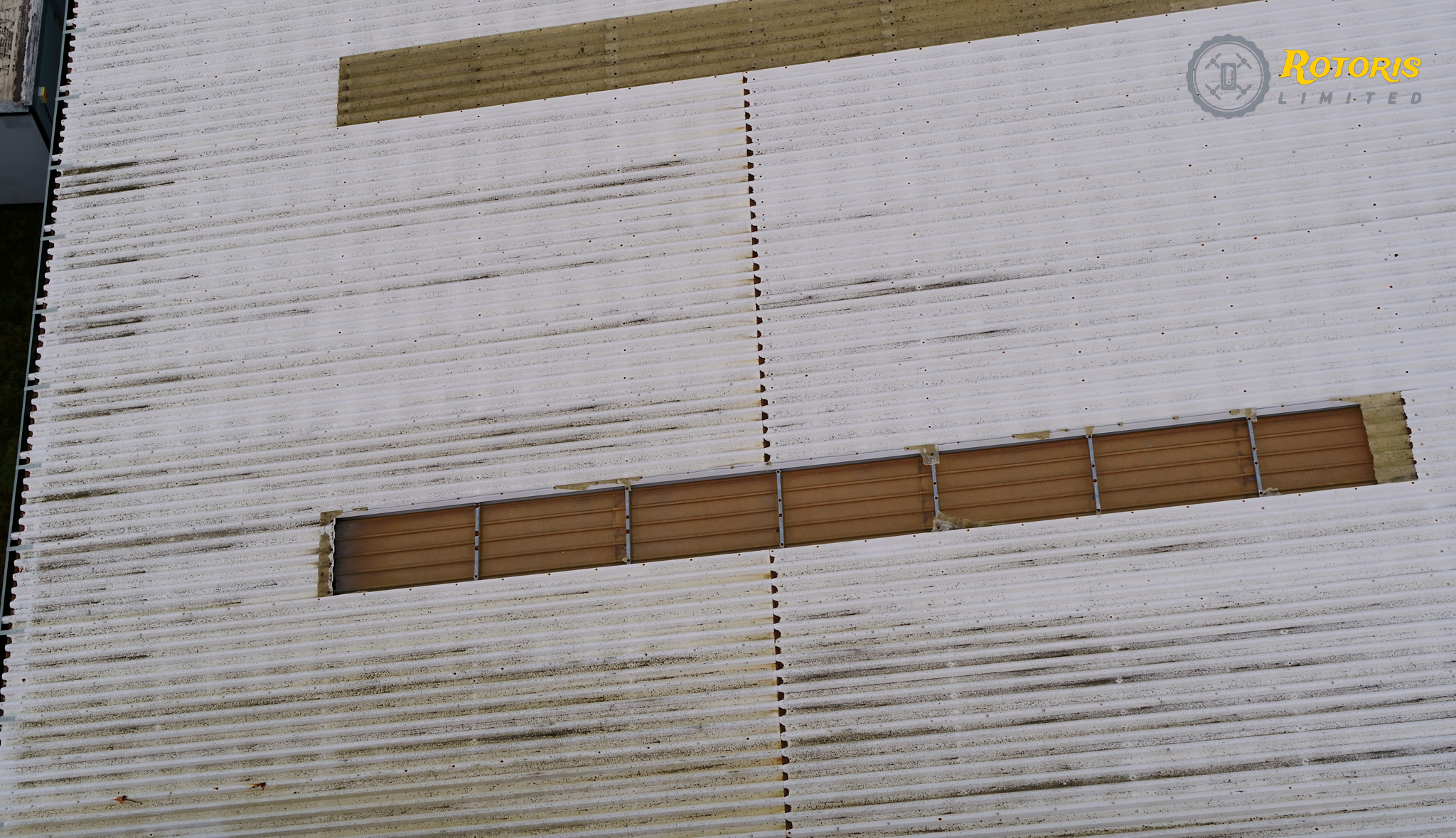
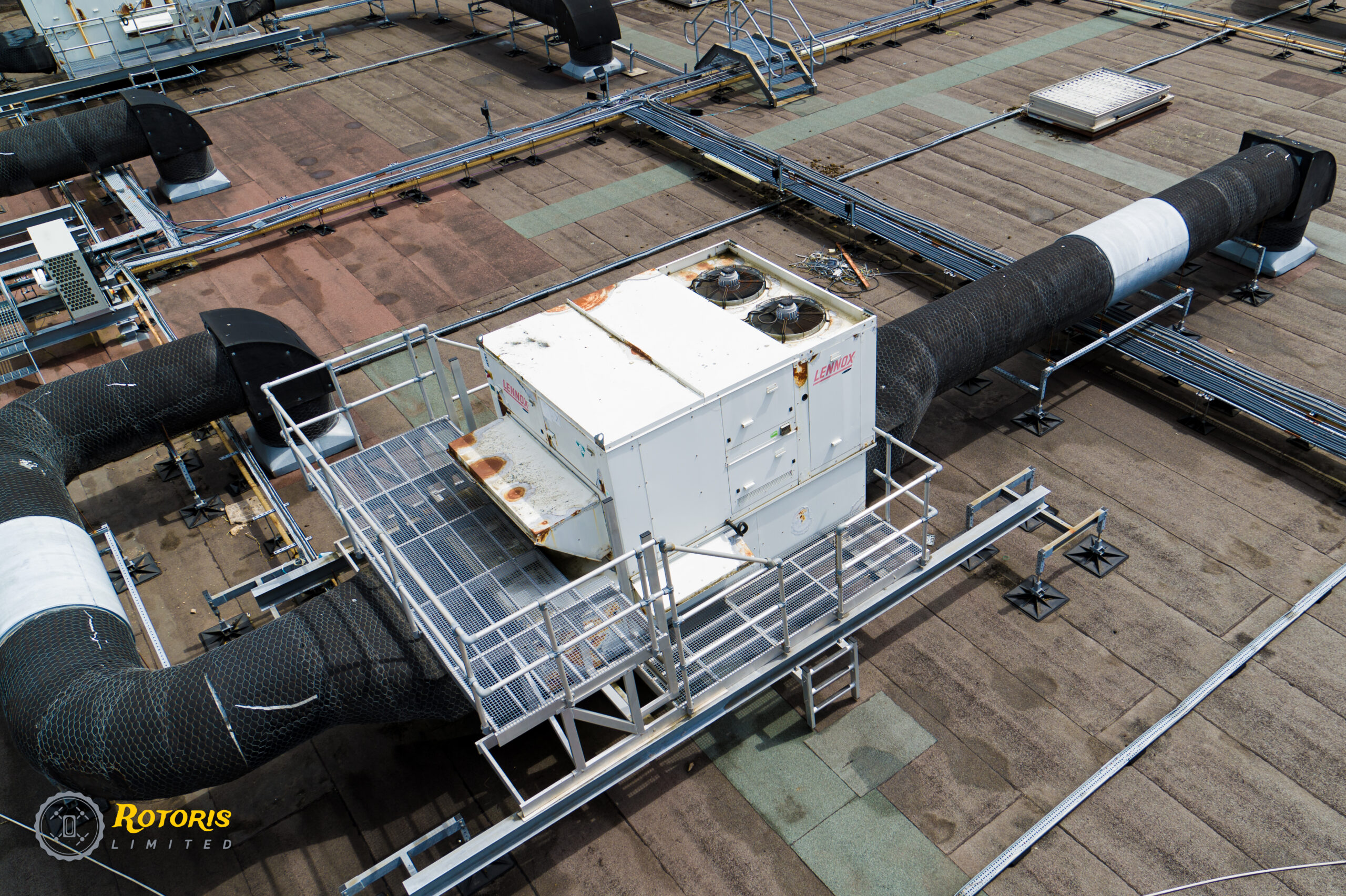
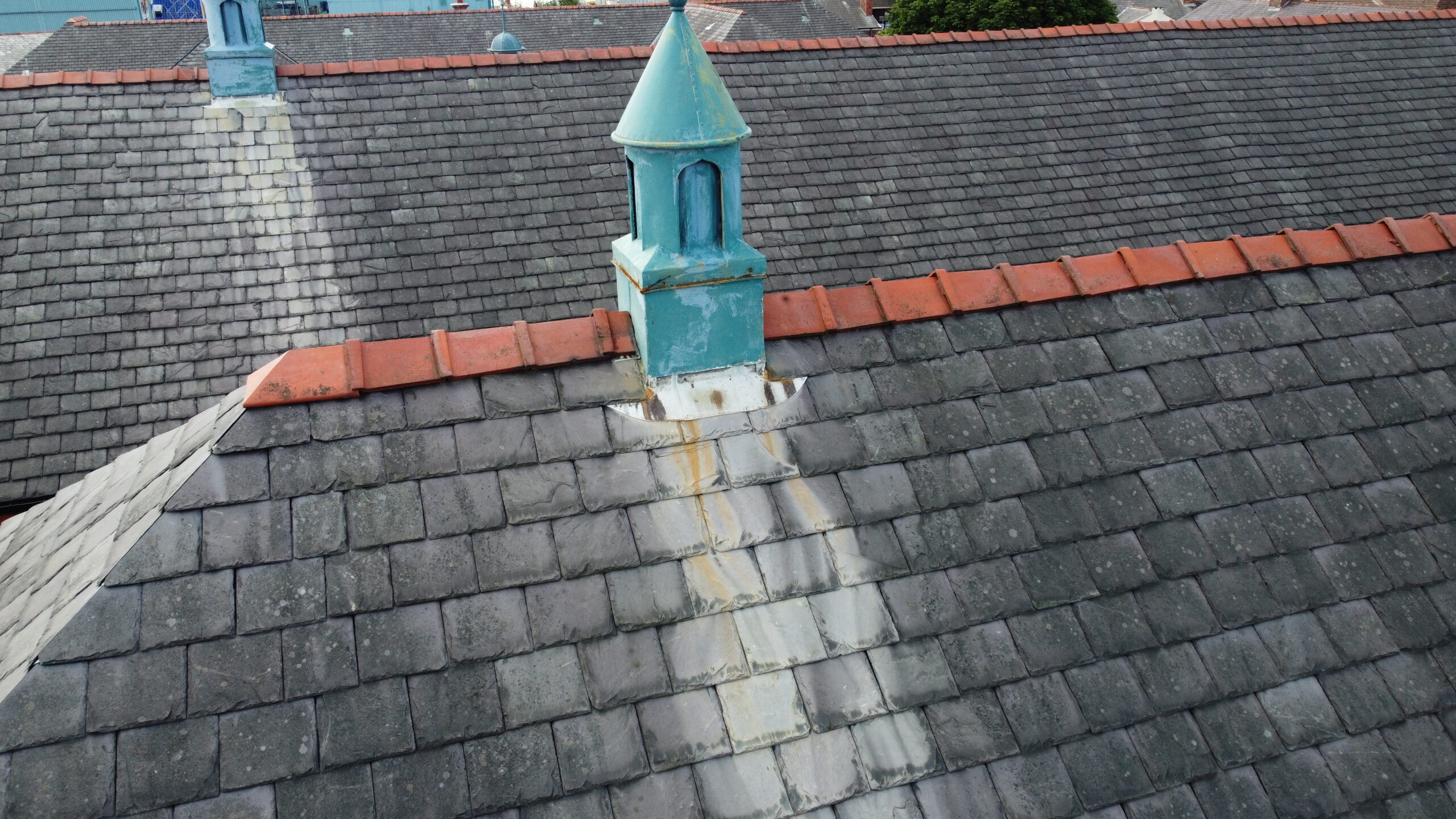
Our drone-based roof and aerial inspections provide a safe, efficient, and cost-effective solution for inspecting inaccessible areas and components in high places.
Comprehensive Condition Reporting
Our aerial inspection services provide detailed condition reports. We capture high-resolution images and video footage of hard-to-reach areas, analyzing this data for a thorough examination of asset conditions. From identifying safety hazards to pinpointing maintenance needs, our inspection reports offer the information needed for informed decisions about your property and assets.
Get greater asset condition insights through:
External Remote Piloted Inspections: Certified remote pilots employ UAVs with advanced cameras, eliminating the need for expensive access equipment. Furthermore, this approach enhances efficiency and reduces costs associated with traditional inspection methods.
Internal Remote Piloted Inspections: Incorporating confined space drone technology, remote pilots efficiently capture vital data in tight spaces. This not only reduces risks to employees but also ensures a thorough inspection. Equipped with 4K and thermal camera systems and high-strength lighting, these inspections offer unparalleled insights with minimal risk.
Comprehensive Condition Reporting: The detailed inspection data is not only captured effectively but also presented in an accessible format. This comprehensive report showcases asset conditions, defect locations, and severity ratings. As a result, clients gain a clear understanding of their assets, facilitating informed decision-making and proactive maintenance strategies.